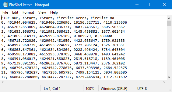
The Fire Size List file is an optional output text file created from a burn probability run. It contains the ignition point(XStart, YStart), FireSize Acres, and FireSize Ha for each fire used in the burn probability run. FIRE_NUM is the unique ignition ID and can be used to link the MTT_Perimeters output. This text file can be used within a GIS to generate a point shapefile of ignition locations.

The Fire Size List file can also be used as an input when calculating burn probabilities from a fire list. The Fire List File can be a file from a previously saved burn probability analysis in FlamMap, FSim, or from a text file created by the user. If a text file is created outside of FlamMap by the user it needs to be a comma or space delimited text file with a minimum of three fields in the following order,
XStart/YStart values also need to be in the same datum and coordinate system as the landscape.