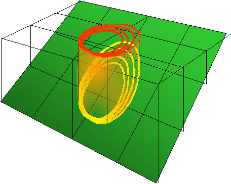
In sloping terrain, the topographic slope and direction of spread on that slope are used to translate the surface coordinates of the fire front to horizontal coordinates. This step is necessary because the Rothermel (1972) spread equation predicts the forward steady-state fire spread rate along the ground surface. As modified by the wind-slope vector, the forward spread rate is used in the acceleration functions (FARSITE) to produce an average spread rate for a given time step. This in turn is used to produce the elliptical dimensions (FARSITE & FlamMap) in units of surface spread rate that input to Richards’ differential equation. The resulting time derivatives for the X and Y coordinates are applied to give the spread of a particular point in units of surface spread distance. These must be converted to the horizontal coordinates. The horizontal projection of an elliptical fire burning on steep ground will appear flattened in the up- and down-hill directions because of this conversion.

Increase uphill Spread Rate and Intensity (parallel to topography), decrease downhill spread rate
Increase Eccentricity of Fire (parallel to topography)
Requires Horizontal Projection for Fire Perimeter Storage and display